
Traditional tethered deployments revolve around a fixed ground station, whereas mobile scenarios require the platform and ground carrier to change together. Vehicle movement, cable angle, and aerial position create new coordination challenges and also open up application concepts such as observation along a route.
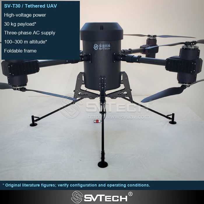
Following is a set of relationships that must be defined
"Automatic following" may mean the aircraft following the ground station, the winch following payout requirements, or the payload following a target—these are entirely different functions. Sharing a name does not mean the sensors, control boundaries, and applicable scenarios are the same.
Following the ground station, maintaining relative altitude, or aiming at a target are not the same control objective. Road bumps and turns change the cable path, and surrounding obstacles further complicate system boundaries. When discussing such functions, the applicable terrain, speed, and exit conditions should be clearly defined. The integration direction is described here; specific capabilities remain subject to model documentation and verification results.
If the ground equipment moves, the system must coordinate position, cable status, and obstacles. The fact that a single component has a following function does not prove that the entire system can operate while moving along any route.
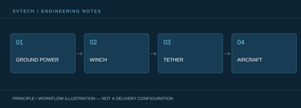
Technical principles and engineering boundaries
A tethered drone connects ground power, the payout/retrieval mechanism, cable, flight platform, and mission payload into a continuous system. When designing around "Mobile Tethered Platform: Keeping Persistent Aerial Capability Aligned with Changing Mission Locations," power efficiency, cable weight, tension variation, payload cooling, and flight control interact with one another. The system cannot be described solely by maximum endurance time; whether it can maintain stable service at a specified altitude, wind condition, payload power, and personnel rotation is what makes a persistently powered drone's capability more meaningful in practice.
Application scenarios and implementation paths
Persistent observation, temporary communication relay, nighttime emergency lighting, and security for specific areas are all missions that a tethered platform may serve. They share a requirement for long-term availability of an aerial position, while each imposes different demands on imagery, link, illumination, or deployment speed. Incorporating mission objectives, ground power, operating area, weather window, and exit path into the plan can turn a tethered drone system from a demonstration device into a service that can be organized on site.
Project verification and continuous optimization
To ground this technical discussion on "Mobile Tethered Platform: Keeping Persistent Aerial Capability Aligned with Changing Mission Locations" in real projects, the verification phase should record configuration version, environmental conditions, measurement locations, and mission results together. Require clear definitions of the follow target, input signals, permissible motion states, and failure responses; verify on representative routes; and use complete functional definitions in project documentation to avoid misunderstanding caused by marketing terms. This information is not supplementary documentation but the common basis for interpreting results, reproducing performance, and continuous optimization.
Related support from SV Tech
Zhuhai SV Tech Co. Ltd. provides product documentation, project requirement communication, and configuration boundary verification for tethered drones and related industry applications. For topics such as "Mobile Tethered Platform: Keeping Persistent Aerial Capability Aligned with Changing Mission Locations," you can describe mission conditions, target outcomes, site environment, and existing equipment together, and Mr. Liu (+86 18688194199, lhc1983@gmail.com) will assist with coordination; specific models, performance, and delivery scope are subject to confirmed documentation and project verification.
Clarify the reference target, permissible movement speed, turning range, positioning source, and behavior on anomaly. Movement of the ground platform simultaneously changes the cable path and forces, so it is not enough to test only whether the aircraft follows. Product function names should correspond to specific configurations and descriptions; do not automatically apply website descriptions of technical directions to every model.
Mobility makes aerial persistence services more flexible but also raises coordination requirements. Only by clearly defining what the platform follows can its value to the mission be judged.
