
An aerial position near a building can provide an open view, but building corners, protrusions, and ground traffic also make the cable route complex. A deployment plan should account for the aircraft, the cable, and the ground station together; none of these elements should be judged by plan-view distance alone.
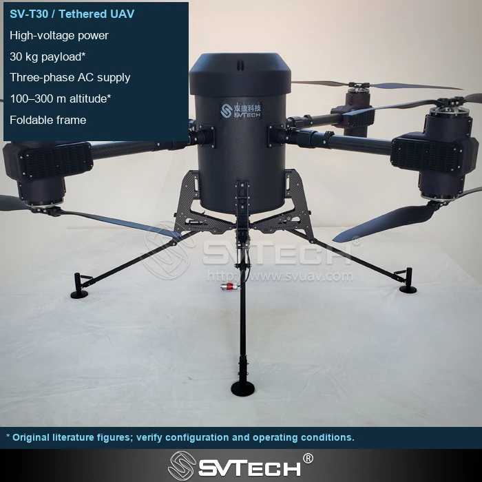
Spatial planning must account for the route after movement
Buildings alter local airflow, and corners and protrusions can also bring the cable into contact with the facade. A safe aircraft position does not guarantee that the entire cable route from the ground station to the airframe is safe, especially during lateral movement and recovery.
An unobstructed takeoff does not mean the same conditions will persist when the platform shifts or lands. The cable's arc in the wind, as well as areas where ground personnel may pass, must be included in the site analysis. A suitable ground station location can sometimes eliminate many route conflicts more effectively than simply increasing flight altitude.
When planning the operating area, map out the possible cable envelope and avoid sharp edges, billboards, and equipment supports. The transition path between working points can sometimes be more prone to contact than the fixed working points themselves.
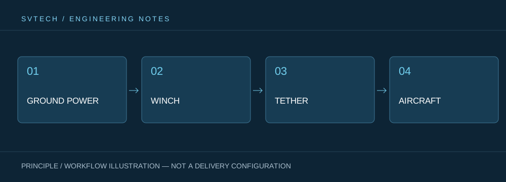
Technical principles and engineering boundaries
A tethered drone connects ground power, the tether management mechanism, the cable, the flight platform, and the mission payload into one continuous system. When designing around "Tethered deployment between urban buildings: coordinating aerial perspectives with ground routes," power supply efficiency, cable weight, tension variation, payload cooling, and flight control all interact. The system cannot be described solely by maximum endurance; whether it can maintain stable service at a specified altitude, wind condition, payload power, and personnel rotation is the more meaningful capability of a continuously powered drone.
Application scenarios and implementation paths
Persistent observation, temporary communication relay, nighttime emergency lighting, and security for specific areas are all tasks a tethered platform may serve. They all require a long-term available aerial position, while each places different demands on imagery, link, illumination, or deployment speed. Bringing mission objectives, ground power, operating area, weather window, and exit routes into the plan together can turn a tethered drone system from a demonstration device into a service that can be organized on site.
Project validation and continuous improvement
To ground this technical discussion of "Tethered deployment between urban buildings: coordinating aerial perspectives with ground routes" in real projects, the validation phase should record the configuration version, environmental conditions, measurement locations, and mission results together. Conduct a site survey to define no-entry directions and recovery corridors; validate at the actual ground station location; when route constraints are discovered, adjust the deployment plan rather than asking the pilot to maneuver around them ad hoc. This information is not supplementary documentation but the shared basis for interpreting results, reproducing performance, and continuously improving.
Related support from SV Tech
SV Tech (SVTECH) provides product documentation, project requirement discussions, and configuration boundary checks for tethered drones and related industry applications. For topics such as "Tethered deployment between urban buildings: coordinating aerial perspectives with ground routes," you can describe the mission conditions, target outcomes, site environment, and existing equipment together; Mr. Liu (+86 18688194199, lhc1983@gmail.com) will assist with coordination. Specific models, performance, and delivery scope are subject to confirmed documentation and project validation.
The layout drawing should mark corners, eaves, protrusions, and edges that may be contacted, and account for the area swept by the cable as the aircraft moves. No contact at rest does not mean there will be no interference during takeoff, landing, and recovery. If the route cannot be clearly isolated, adjust the deployment position rather than relying on the operator to continuously correct while hugging obstacles.
Urban tethered applications require careful spatial organization. Only by finding a complete, manageable connection route can a service from height function continuously and reliably.
